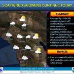


The National Weather Service has issued a flash flood watch for Southern California from the Orange County coastal areas east to the Riverside and San Bernardino County mountains. In addition, a winter storm watch has been issued for the same area above 6,000 feet Friday through Saturday night.
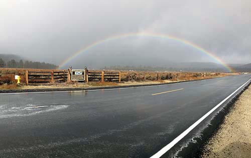
NWS is predicting periods of heavy rain from Friday through Saturday. Light rain has already begun falling on the Hill. Keenwild Ranger Station had recorded about .26 inches between 5 a.m. and 10 a.m. This modest amount will grow significantly, particularly tomorrow, Friday. Several inches of rain are likely through Saturday along the California coast with the heaviest rain focusing along the coast of Southern California.
"I would expect to see some amounts in the 6- to 8-inch range Friday into Saturday in the mountains with 4 to 6 inches in the spots in the lower foothills. This would include the recent burn area around the San Gabriel Valley." Accuweather.com Western Weather Expert Ken Clark said.
The rain totals will create the greatest threat for flash flooding over the mountains and particularly in the recently burnt areas where debris flows are possible. The NWS specifically identified some risk of debris flows from the Mountain Fire in the San Jacinto Mountains. It is possible that debris may flow into a portion of Palm Springs.
In preparation for these two Pacific storms, CAL FIRE/Riverside County Fire Department has delivered sand and sandbags to burned areas from last year’s wildland fires — Mountain and Silver fires.
Two RCFD fire stations on the Hill will have sand and sandbags:
Garner Valley Station 53 (59200 Morris Ranch Road)
Poppet Flats Station 63 (49575 Orchard Road)
All other Riverside County Fire stations stock stand bags only (no sand) in limited supply. If you have eminent or active flooding inside of your residence, dial 9-1-1.
RCFD urges residents in and below the burned areas to prepare their homes in advance of potential flooding.
Steady rain, heavy at times will fall Friday, then turn to showers Friday night and continue Saturday, according to the NWS.
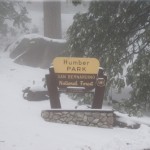
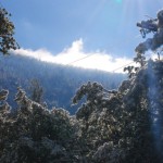
Snow levels will be quite high on Friday — around 7,000 ft. Snow accumulations may be 6 to 10 inches above 6,000 feet with local amounts up to 3 feet above 7,500 feet.
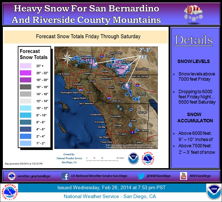
Friday morning, snow will begin above 7,500 feet continue through the day. Snow levels will gradually drop to around 6,500 feet Friday evening and eventually to 5,500 feet on Saturday. Snow showers will continue through Saturday and decrease Sunday. Sunny skies are expected to return Monday.