


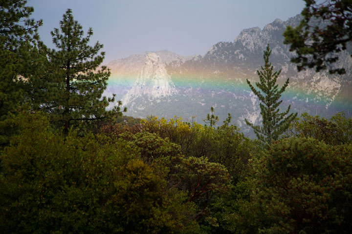
Hurricane Norbert, which formed last week and evolved from a tropical storm into a hurricane on Sept. 3, moved north from Mexico and Baja along the California coast. As Norbert weakened, it drew significant moisture into the atmosphere and over the local mountains.
The storm’s intensity varied through the local area and region. Sunday afternoon, almost 1.8 inches of rain fell at the Idyllwild Fire Station and 1.6 inches in Pine Cove. However, the U.S. Forest Service recorded just 0.1 inches of precipitation at the Keenwild Fire Station.
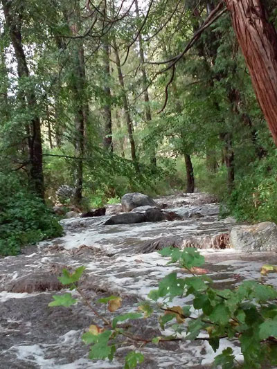
Photo by Shana Wyatt
The gauge on Mt. San Jacinto recorded 1.5 inches of rain late Saturday afternoon, but only 0.12 inches at the peak on Sunday.
At Vista Grande, further north, 0.75 inches was recorded.
Both Sunday and Monday, the National Weather Service issued flash-flood warnings for Riverside County Mountains and desert areas.
Highway 74 was closed for nearly five hours Sunday afternoon from Willowbrook Road to Mountain Center. At the Cranston Fire Station 2.1 inches of rain fell in two hours. This was the most recorded in the area. The flash flooding and debris created an impassable situation, which Caltrans cleared.
An off-road vehicle got trapped in the water near the bottom of Bee Canyon, according to Darren Meyers, public information officer for the California Highway Patrol San Gorgonio Pass unit.
Norbert was the 14th named tropical storm during the busy Eastern Pacific storm season.
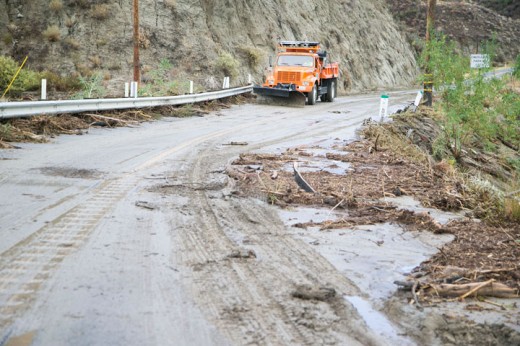
Photo by Jenny Kirchner
Fall tropical storms are not unusual in this area. The National Weather Service has records of major storms back to August 1878. In September 1997, Hurricane Nora brought almost 5 inches of rain to Mt. San Jacinto and nearly 3 inches at the Idyllwild Fire Station. But that pales compared to the 10 inches at the peak and almost 4.5 inches in town that fell in September 1976 due to Tropical Storm Kathleen.
However, the cooling rain is not a harbinger of an El Niño relief to the current three-year drought. Last week, National Weather Service forecasts said, “At this time, the consensus of forecasters expects El Niño to emerge during September-October and to peak at weak strength during the late fall and early winter.”
Last week’s report placed a 60- to 65-percent chance of an El Niño pattern developing during the fall and winter.
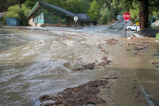
Photo by Jenny Kirchner
The Cal Fire Predictive Services forecast for September through December reinforces this forecast: “Precipitation is still expected to be near average this winter, but the prospect of wintertime rainfall bounty courtesy of a strong El Niño is probably off the table.”
As a consequence, it opined, “Large fire potential may not decrease to normal over Southern California until December.”
While a reprieve from the drought does not appear imminent, a recent study published in the “Journal of Climate” predicted that the current drought has an 80 percent chance of lasting a decade.
This research combined paleoclimate data with climate model projections to arrive at this estimate.