Updated 4 p.m.
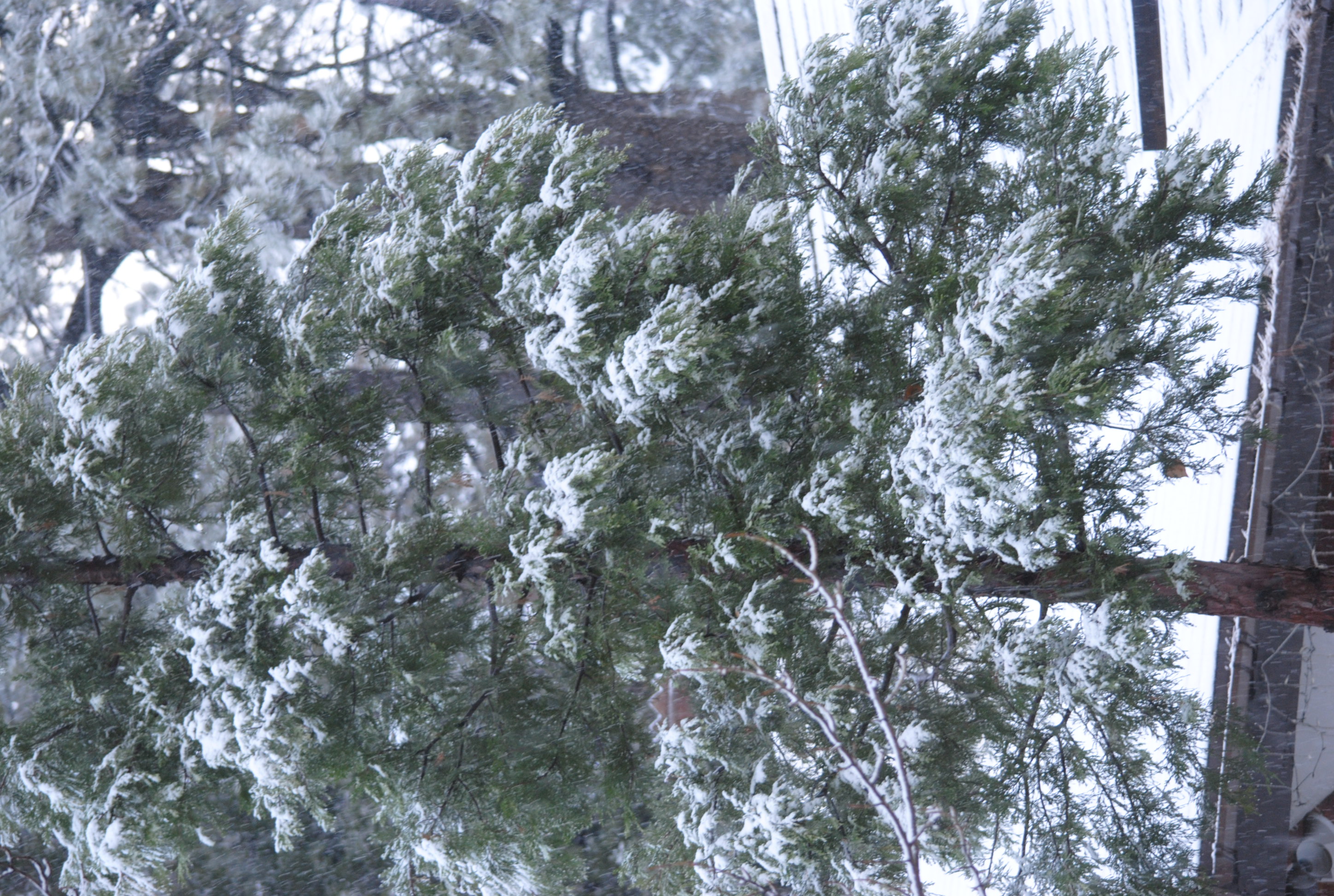
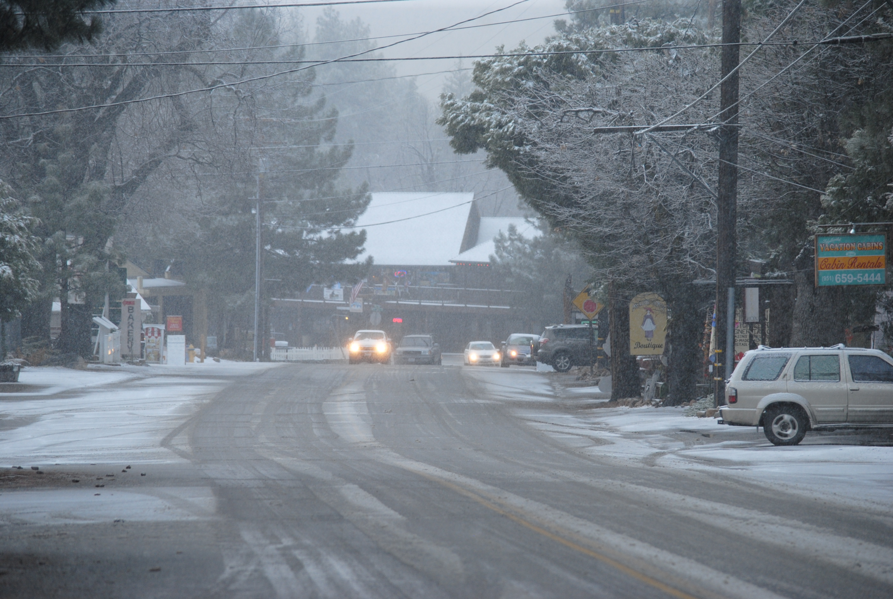
Despite the National Weather Service’s forecast of less than inch accumulation this afternoon. Here’s the view from N.Circle Drive in front of the Town Crier office.
This morning, Thursday, Dec. 19, the National Weather Service issued a Winter Weather Advisory for the Southern California Mountains, including the Hill, from Thursday morning, Dec. 19, until early Friday morning.
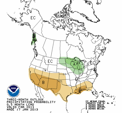
The NWS snow forecast for Idyllwild has diminished considereably since yesterday. This morning, NWS is still predicting snow showers to begin falling late Thursday morning; but daytime accumulation is now expected to be less than inch. During Thursday night, additional accumulation of 2 to 4 inches is still possible. Snow should taper off Friday morning and perhaps sunny, with temperatures near 50º F Friday afternoon. The weekend forecast is also for sunny and mid-50s.
A cold low pressure system moving in from the northwest will bring periods of snow and gusty winds to the San Bernardino County mountains, the Riverside County mountains and the San Diego County mountains. Within the advisory area, the NWS includes the following locations: Aguanga, Anza, Garner Valley, Idyllwild, Mountain Center, Pine Cove, Pinyon Pines, and Vista Grande.
The Winter Weather Advisory remains in effect from 7 a.m. Thursday, Dec. 19 to 1 a.m. Friday, Dec. 20.
* Snow levels — starting around 7,000 feet this morning and dropping to between 3,500 and 4,000 feet by Thursday evening.
* Timing — light snow showers will continue this morning in the higher elevations of the Riverside County Mountains; coverage and intensity will increase this afternoon and spreading south into San Diego County. Showers will taper off Friday morning.
* Snow accumulations — generally a dusting below 4,000 feet; 2 to 4 inches between 4,000 and 6,000 feet; and 5 to 7 inches on the highest peaks.
* Winds — southwest to west 20 to 30 mph with gusts to 50 mph and isolated gusts to 60 mph near mountain ridge tops.
* Visibility — locally reduced at times due to blowing snow and fog.
* Impacts — residents and travelers into the mountains should be prepared for hazardous winter weather conditions and possible road closures. If possible carry chains and take extra food and clothing.
* Outlook — snow showers may linger through Friday but the snow level will rise, which will confine any additional accumulation to the highest peaks.
Precautionary/preparedness actions — a winter weather advisory means that periods of snow will cause travel difficulties. Be prepared for slippery roads and limited visibilities and use caution while driving.