The massive snowfall from the late February and early March storms spared the Hill from the damage 7, 8 or 10 feet of snow can cause.
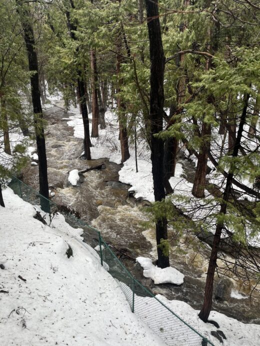
But last week’s rainstorms, another atmospheric river, poured on the Hill. By Saturday evening, March 11, the National Weather Service (NWS) recorded 2.34 inches of rain at the Pine Cove Dutch Flat station. That was the greatest rain in Southern California during the 24-hour storm.
Pine Cove West received 2 inches, the third greatest precipitation fall during this period. Alandale (Stone Creek) recorded 1.93 inches, which tied it for the fourth greatest rain, Pine Cove Rocky Point was sixth with 1.94 inches and Keenwild rounded out the top 10 rain areas with 1.83 inches.
That is a lot of rain. Only four years ago, February 2019, the Hill received nearly four times this level of precipitation, which resulted in portions of highways 74 and 243 washing out. The roads were closed for months and initially opened only with escorts.
The weekend and Monday and Tuesday were drier, but NWS is forecasting another atmospheric river to arrive over Southern California late Tuesday through Wednesday. The rain estimate for this storm is unreliable as of Sunday.
“Some solutions show rain arriving as early as Tuesday afternoon and others as late as Wednesday morning,” NWS forecast Sunday. “As the bulk of the deep-layer shifts southward, the flooding threat could expand southward into San Diego County. Current estimates for rainfall amounts are about 2 inches in Orange County, up to 1.5 inches in the Inland Empire … up to 2.5 inches in the San Diego County mtns … The rain will change to showers Wednesday morning, then end from northwest to southeast in the afternoon and evening.”
Snow may fall Wednesday afternoon at the 5,500- to 6,000-foot elevation, according to NWS on Sunday. While dry weather returns for a few days, more rain is possible next weekend.
The weather is presenting Southern California, including the Hill, with the proverbial, “Good news or bad news” conundrum. The La Niña weather pattern, unusually dry, is ending.
Later this spring or summer, an El Niño pattern should develop. This is more often associated with greater precipitation. “La Niña has ended and ENSO [El Niño-Southern Oscillation]-neutral conditions are expected to continue through the Northern Hemisphere spring and early summer 2023,” NWS forecast last week.
This La Niña brought a second and more severe drought to the state. But this winter’s storms have greatly improved drought conditions. The Hill has received about 85% of the average rain from Oct. 1, the beginning of the rain year, through now.
At Thanksgiving, only three months ago, all of California was considered in some stage of drought. As of March 7, nearly 26.4% of the state is free of drought. This is also a 10% improvement since the end of February. August 2020 was the last time this much of California was drought free.
And at the end of November, nearly 40% of the state was in either extreme or exceptional drought, the two worst conditions. As of last week, none of the state was considered that bad. More than half of California is only abnormally dry or moderately dry.