While the daytime temperatures seem to hide winter’s presence, forecasters assure us that colder weather is coming.
Unfortunately, they offer no assurance about winter precipitation. The state’s Department of Water Resources’ first 2014 snow survey had disappointing results.
“California’s dry weather pushes into the new year,” DWR announced Friday, Jan. 3. “Its first snow survey of the winter found more bare ground than snow. Manual and electronic readings record the snowpack’s statewide water content at about 20 percent of average for this time of year.”
DWR has established a drought-management team to prepare for a dry 2014, which will be the third consecutive year of below-normal precipitation.
The last time California’s statewide snowpack was this dry was in 2012 when it also was 20 percent of the historical average. The readings today and in 2012 are the driest on record. In addition to the sparse snowpack, many areas of California ended 2013 with the lowest rainfall amounts on record. Normally one of California’s wettest spots with an average annual rainfall of nearly 100 inches, Gasquet Ranger Station in Del Norte County ended the year with only 43.46 inches.
2013 will go down as one of the driest on record across the state. The root cause of these dry conditions was the persistent ridge high pressure located offshore much of the year. This ridge kept storms far to the north and very few Pacific storms reached the coastal areas of the state, according to the Cal Fire South Operations Predictive Services report for January through April 2014.
Cal Fire weather forecasts do not see much hope for a wet winter. Precipitation totals will likely remain below normal through the winter. However, some rain may appear during the second half of January. While rainfall may still be below-average during the second half of January into February, conditions may be slightly less dry than the record drought now gripping the area, according to the Predictive Services report.
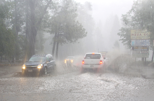
Despite heavy rainstorms in September, rainfall recorded at the Idyllwild Fire Station in 2013 was 13.6 inches, compared to the long-term annual average of 25.7 inches. Keenwild Ranger Station has recorded 6.6 inches of rain since July 1. Since 1946, when Idyllwild Fire began recording weather, the long-term average for the July 1 to Dec. 31 period is 9.2 inches, because the bulk of precipitation historically falls from January through March.
Snowfall last year totaled 42.8 inches, about the same as 2011-12. This is slightly more than the annual average of 38.2 inches.
While Fern Valley and Pine Cove water districts’ water supplies are plentiful, the groundwater level of several of their wells has been dropping. However, Idyllwild Water District, which relies much more on stream water, has already declared a Stage 2 Water Emergency and may consider moving to Stage 3 later this winter or spring, according to General Manager Terry Lyons.
Already, the persistent dry weather has allowed the bark beetle to re-emerge as a significant threat to local pines — with ultimately, as the trees die, a greater fire potential.


