Last week, the National Weather Service raised the probability that an El Niño event will continue through the winter to 95 percent, up from the August estimate of 90 percent. The event is expected to gradually weaken in the spring.
“El Niño is now strong with a 95 percent chance it will last through the winter,” said Michael Halpert, deputy director of the Climate Prediction Center.
While “climate systems are complicated,” Halpert expects the fall to be mild and winter impacts to be much stronger, including above-normal precipitation. However, he cautioned “ … because it is favored, doesn’t mean it will happen.”
He also stressed that one season of above-average precipitation will not be sufficient to “erase four years of drought.”
Last week, nearly 0.4 inches fell at Keenwild Ranger Station, bringing the total rainfall since July 1 to 3.8 inches, compared to the long-term average of 2.35 inches form July 1 through September. More rain is expected this week.
Based on the current oceanic and atmospheric data, Halpert believes the approaching El Niño “… could be one of the three strongest we’ve seen.
“By any measure, ’97-98 is still stronger than 2015,” he stated, and the 1987-88 El Niño was stronger than the 2015 is anticipated to be.
As fall and winter near, Halpert said NWS will be studying a large patch of warm water off the Gulf of Alaska. Currently, it expects Hawaii to have a drier season than normal, but the warmer water between the islands and Southern California might produce wetter storms or even warmer storms, according to Halpert.
However, the strength of El Niño will depend on the tradewinds crossing the Pacific Ocean. “The winds are important and normally easterly … if there is no collapse of the trade winds we might be near the peak.”
State Climatologist Michael L. Anderson recently issued the following statement on potential El Niño conditions: “Current El Niño conditions cannot tell us how many storms may cross California this coming winter or how much rain and snow will fall in our state. Strong El Niño events in the past have led to wetter-than-average conditions in the southern part of the state but offered mixed results for California’s main water supply regions in the north.
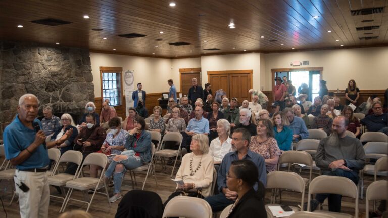
Earlier this month, a record number of Hill residents attended the Mountain Disaster Preparedness group’s “El Niño and Hill” event to hear Alex Tardy, warning coordination meteorologist for the National Weather Service in San Diego, speak about the approaching fall and winter weather.
One of the questions asked at the session was whether sandbags would be available to local residents.
Sandbags will be available at several local government sites. Idyllwild Fire Chief Patrick Reitz said the fire department will have bags, but no sand. However, he stressed, “Sandbags are a temporary fix for a temporary problem. If one knows of a problem, for example, floods every year or through a yard, take precautions, every possible step, before the next rain.
“With no impending weather, we are not issuing sandbags now,” he said. “The time to prepare is now.”
Property owners concerned about potential flooding and run-off should be taking action now — building berms, dikes, dams or other water diversions — to protect their property. These actions should not shift the problem and exacerbate damage to neighboring parcels, he emphasized.
Sandbags will be available at two other locations. Kathleen Henderson, the Riverside County emergency services coordinator for the mountain, confirmed that Riverside County Fire Station 23 (Pine Cove) will have bags available.
She also emphasized that the bags are for emergencies and distributed closer to an expected major weather event.
Pine Cove Water District will have sandbags, wood chips and some netting available, according to General Manager Jerry Holldber. These will be available to PCWD customers. Sand may also be available, but that won’t be known until October.


