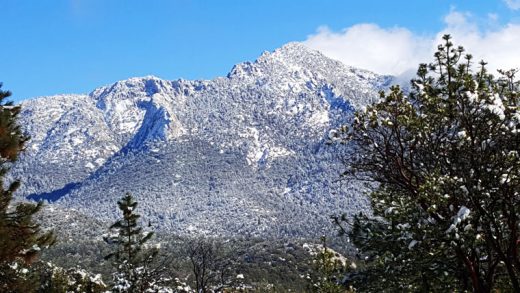
The first weekend of 2019 was wet with rain drenching the whole Hill and some areas receiving a covering of snow.
The National Weather Service’s forecast for this storm expected most of the snow to fall in the San Bernardino Mountains. However, it was the San Jacinto Mountains that received the snow, but almost all of it was at high elevations.

Photo by Steven King
Flurries fell in Idyllwild with some slushy accumulation. But 6 inches of snow fell in Pine Cove, 4 inches were recorded in Fern Valley and north of Pine Cove collected about 3 inches of snow. Yet the greatest snowfall recorded from this storm was 9 inches at the Long Valley Ranger Station near the top of Mt. San Jacinto.
The northern areas of the Hill recorded the most rain. The U.S. Forest Service’s Vista Grande Ranger Station recorded 1.1 inches of rain. Keenwild Station received an inch. The Garner Valley collection site recorded about 0.8 inches of rain.
About 0.9 inches were recorded at the Idyllwild Fire Station.
While this was a substantial increase in rainfall since Oct. 1 at both Idyllwild and Keenwild, the three-month totals of 5.5 inches at Idyllwild and 6.5 inches at Keenwild are still below the long-term average of 6.9 inches for these three months.
The forecast for the next week repeats the recent pattern of potential storms, but not necessarily a big one.
The next possibility of rain is the weekend. “For late Friday into Saturday, a low pressure system from the west with a subtropical moisture connection will move into Southern California, then weaken as it moves inland,” according to Monday’s NWS forecast discussion.


