Spring, according to the calendar, is still a week away. But the rain and snow in the past five weeks have sprung the local springs.
Runoff continues to flow down many streets, often through yards and under or into homes. Last week, less than an inch of rain was recorded at the Forest Service’s Keenwild Ranger Station; yet the sides of many local roads still have water running along the curbs and into drains.
About a third of an inch fell in Garner Valley and closer to a quarter of an inch was recorded at the Idyllwild Fire Station.
With the calendar approaching Spring, the weather appears to concur. Drier and warmer trends have been forecast beginning Wednesday and Thursday, March 13 and 14. Idyllwild may heat up to the 50s and 60s during the next week.
Since Oct. 1, 2018, total rainfall through Monday, March 11 recorded at Keenwild has been 26.4 inches. The long-term average for a year is 25.7 inches, of which about 20.5 falls between October and the end of March.
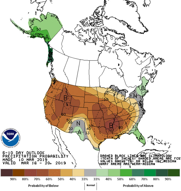
The National Weather Service’s forecasts for the next 6 to 10 days, for the next two weeks and for the next month all show below average precipitation.