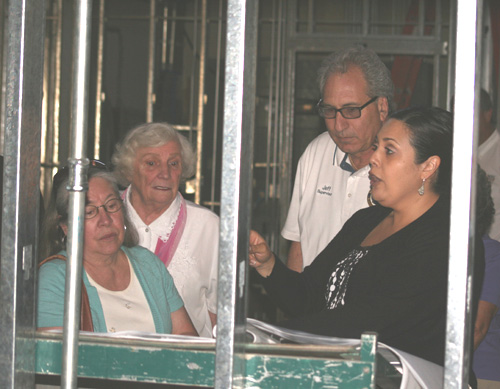
Representatives of member agencies held the first of this season’s
meetings of the Mountain Area Safety Taskforce (MAST), at the Idyllwild
Nature Center Wednesday, March 13. The participating agencies included
Riverside County Sheriff, CalFire, United States Forest Service (USFS)
and Idyllwild Fire Protection District (IFPD). The audience included a
member of the Mountain Community Fire Safe Council (MCFSC) and a handful
of interested locals.
Although few members of the public attended, speakers expressed the
hopes that attendance will improve Wednesday, June 12. MAST forums were
public affairs until COVID curtailed them. The agencies within the group
continued to meet virtually and are now getting back to involving the
public in their mission of “Helping to prevent catastrophic wildfires in
Riverside County.”
IFPD’s Jim LaMont began with an update of his agency’s efforts.
Staffing, he said, was holding well. Nationwide, fire departments
struggle with hiring and retention, and Chief Mark LaMont, at
commissioners’ meetings, often points with pride to his staff and Crew
- Jim reported that IFPD’s new communications site is up and running,
but more work remains to be done by Edison to ensure a “bullet-proof”
power supply. CPR classes continue for USFS personnel and members of the
public (contact the IFPD office for more info.)
Control burns are expected to resume soon for the Bear Trap project that
stretches from Camp Emerson to Buckhorn Camp. Other fuels reduction
efforts in conjunction with USFS, including Thomas Mountain, also will
resume. Property abatement inspections for Idyllwilders are expected to
begin April 15.
Jim Snow, USFS San Jacinto Ranger District (SJRD) fire management,
reported that abatement projects in “admin” areas surrounding the
stations are “98 or 99% done,” with only two piles, each containing
fuels from a few acres, awaiting burning. Returning to the Thomas
Mountain project, he recapped last year’s effort: 2,500 acres treated in
a mosaic pattern of burns. This covered three “units,” with two more
scheduled for this year “around about June.” Last year, Snow said, the
burned areas “only smoked for about 17 to 20 days, then we monitored it
for about 30 days.”
Other fuelbreak systems in Garner Valley will possibly be treated this
season, including Trails End, Mountain Canyon, Bonita Vista, May Valley
and Camp Ronald McDonald. He spoke of a “five-year approach,” the target
for returning to maintain existing fuelbreaks. Another aspect of these
projects is compliance with environmental restrictions. The agency must
identify areas with restrictions, and either comply with them or go
through a process to have them lifted. The responsible agencies have
evolved in their attitude toward fire suppression, and some of these
restrictions were put in place 50 years ago, under a very different
regime.
Snow wished to draw attention to the service’s new Wildfire Crisis
strategy
(https://www.fs.usda.gov/sites/default/files/Wildfire-Crisis-Implementation-Plan.pdf).
The plan calls for an “unprecedented paradigm shift in land management
to increase fuels and forest health treatments across jurisdictions to
match the actual scale of wildfire risk to people, communities, and
natural resources, especially in the Western United States.” It includes
community protection, forest health and watershed protection, as Snow
put it, “all grouped into one instead of looking at them separately.” He
noted that we are in an “identified zone” in the plan, what the document
calls a “High-Risk Fireshed.” This means “we take priority… we are very
fortunate here in the San Jacinto and San Bernardino Mountain forests to
get that attention, which gets us the help to get it done.”
CalFire Division Chief Dan Olson, Riverside County Fire Department for
Division 6, and an incident commander (IC), gave an update on
suppression efforts. April 15 marks “spring transition” as the seasonal
workforce is brought into the field, increasing the staffing for Type
III, or woodland fire, engines. This includes engines and crews at Pine
Cove, Garner Valley and Anza. These are additional units to “bolster”
year-round crews at stations 23 (Pine Cove) and 53 (Garner Valley.)
Also in April, CalFire will conduct annual In Service Training. Crews
from around the county and partners further afield will congregate for
exercises at Twin Pines Ranch (near Banning). The “cooperators” interact
with local agencies and get to know each other and the terrain.
Residents should expect a large contingent of fire equipment coming up
243 and 74 during this training.
Olson noted that the county, through its Emergency Management
Department, is working on a new program of notifications for evacuation
warnings and orders. The platform is called “Zonehaven,” a privately
developed tool for first responders that allows messaging residents by
zone when fire threatens a community. It is used throughout the state,
Olson said, and the county has now purchased it. Predetermined zones are
being identified to allow ICs to streamline notifications. This is “not
a lot different from what we are doing currently; we are using military
grade,” meaning the system developed by the Department of Defense. The
new system will be rolled out this month and with “heavy messaging”
inviting residents to sign up. This is done at Genasys Protect
(protect.genasys.com), a mobile app. The system is integrated into the
existing MAST Plan zones. The service also will provide advisories, so
that when, for example, the USFS is doing a control burn, residents
downwind will know to expect smoke.
Sgt. Rick James of Riverside County Sheriff’s Office took the
opportunity later to clarify evacuation warnings and orders. A warning
gives you time to prepare to evacuate, gather what you wish to take,
pack your vehicle, prepare your home, all according to the plan you
should already have. An order means you are in the path of fire and
crews need you out of the way to do their jobs. You will not be forced
to leave your property, “we’re not going to drag you out by your ears,”
but residents that stay behind often need to be evacuated later by fire
personnel. This takes equipment and crews away from carefully planned
assignments and endangers others, including the firefighters, so “please
heed evacuation orders.” During the Fairview Fire there were deaths
because “people waited for too long.”
Lynette Short, CalFire unit forester and public information officer,
pointed out that members of the public who wish to ask questions at
future MAST meetings may send the questions in advance to get more
thorough answers, to Leighanne.Calacuayo@fire.ca.gov. Short discussed a
number of fuels projects and grants.
The Astrocamp fuels reduction project was small by CalFire standards,
about 85 acres on both sides of Highway 243, “the entrance to Idyllwild.
Within the last two years we treated all 85 acres.” The project
consisted of “hand cutting, chipping, a little bit of mastication.” The
project was put in place in 2017 before the Cranston Fire and is an
identified hazard, a canyon or chimney leading to an educational
facility and the town. It is a State Responsibility Area (SRA) and Short
mentioned that land on the Hill goes “back and forth” in terms of
responsible agencies between USFS, CalFire, IFPD and other fire
agencies.
Mt. San Jacinto State Park pile burning is about half done, according to
Short. “There were thousands of piles out there.” Some of the piles are
under snow now and that will delay further burns. “As soon as that snow
melts, you’ll see CalFire crews out there assisting the state park,
trying to get the majority of those piles burned off before fire season
hits.”
The Red Hill and Point of Rocks projects are to others. Red Hill is a
200- to 300-foot-wide break, over 232 acres, to the west and northwest
of Pine Cove. It is noncontinuous over multiple plots of land, and
includes high priority areas like that around the Nature Center, and
“ingress and egress areas” essential for safe evacuations. This is
another place residents should expect to see CalFire heavy equipment,
crews and masticators at work. The project was approved in 2019 but
delayed due to “lack of resources.” About 140 acres were treated last
year, and the agency hopes to get the rest in 2024.
The Point of Rocks project sits on the north and northeast side of Pine
Cove. It is a continuous, 500-foot-wide break, untouched since 2019 and
ready for retreatment. It is rugged terrain. Funds give CalFire the
option of contracting some of the work out to private companies.
Short’s responsibilities include wildfire protection grants, some MCFSC
administers focusing on dead and dying trees and Gold Spotted Oak Borer
(GSOB) trees. The group also is receiving new grants including one that
will run through 2029 to abate vacant parcels. While most homeowners do
their abatement, neighborhoods are a “patchwork” that includes
undeveloped properties whose absent owners do not abate. MCFSC is doing
an analysis to determine high priority parcels, including along
evacuation corridors.
Other work on the Hill is funded by CalFire Forest Health grants.
Recipients include Riverside County, California State Parks and USFS.
The State Parks have treated GSOB trees on over 13,000 acres and are now
monitoring them. Treatment includes chemicals intended to bond to the
trees and not wash away into the environment. The Crier reached out to
CalFire to get the names of the chemicals being used but had no response
by press time. USFS continues reforestation efforts on land hit by the
Cranston Fire, also funded by a Forest Health grant.
Short was asked about cooperation with tribes. The preferred phrase is
now “local, state, federal and tribal authorities” when speaking of
forest management. Short said, “There’s a lot more collaboration with
tribes than what was done 10, 20, even five years ago.” She noted that
CalFire has a Tribal Wildfire Resilience grant program.
Samuel German, SJRD fuels officer, offered an invitation to residents
who wish to gather firewood. Piles and log decks are available, and the
Ranger Station (54270 Pine Crest Ave.) will issue permits ($40 for up to
two cords) and maps of pile locations.
James wanted the public to know that the Lake Hemet substation is not
normally staffed: although eight deputies use it, and there are always
two officers on duty on the Hill, it is a large beat and citizens should
not expect to find an officer at the substation. If officers are there
you may talk to them, he said, also noting that members of the public
sometimes arrange to meet deputies there if they do not wish to meet
them at home.
If a caller has a doubt about the status of a call, they should err on
the side of caution and call 911, James underlined, but if they are
calling about a longterm situation or one they know does not require
fast response, they may use the nonemergency number (951) 776-1099 to
keep from overloading the 911 system.
LaMont also spoke about the local emergency warning sirens. The downtown
siren, at the fire station on Maranatha Drive, is tested on the third
Saturday of every month. There are plans to expand this with speakers
that will reach Pine Cove, Mountain Center and even Vista Grande. In the
near-term, expect a siren on Fern Valley Water District land. If a siren
is heard at times other than the third Saturday test, tune into WNKI,
1610 AM, for further information.
Woody Henderson of MCFSC provided on update on activities as it ramps up
for summer. It has just received another large grant to help with
abatement of dead and dying trees and GSOB trees. Inspectors are sent
out who assess the condition of trees and solicit bids from contractors,
paying most of the cost of the work with grants, the homeowner paying
the rest. Residents may call (951) 465-4142 to learn more, or
visit mcfsc.org. The website notes that some grants are tailored to
seniors and low-income homeowners.
The next MAST meeting is 11 a.m. Wednesday, June 12, at the Idyllwild
Nature Center.