Photo courtesy National Weather Service
Keep the faith, is the National Weather Service’s advice regarding the appearance of “El Niño” this spring.
During the fall, forecasters were awash in warnings about the arrival of an El Niño event comparable to the 1982-83 and 1997-98 seasons. Public agencies, at all levels — local, state and federal — were advising Southern California residents to obtain sandbags, flood insurance and more.
Yet February 2016 resulted in one of the driest Februarys on record, according to Alex Tardy, NWS meteorologist in the San Diego office. Riverside city received about half the rainfall that fell during 1997-98.
“February was not even close to the historic pattern,” Tardy said.
A high-pressure system hovered over the state since late January. The El Niño conditions did generate the projected storms, which were just as strong as the 1997-98 storms, but this high-pressure zone drove them north. The Northern California mountains have received almost a normal amount of precipitation.
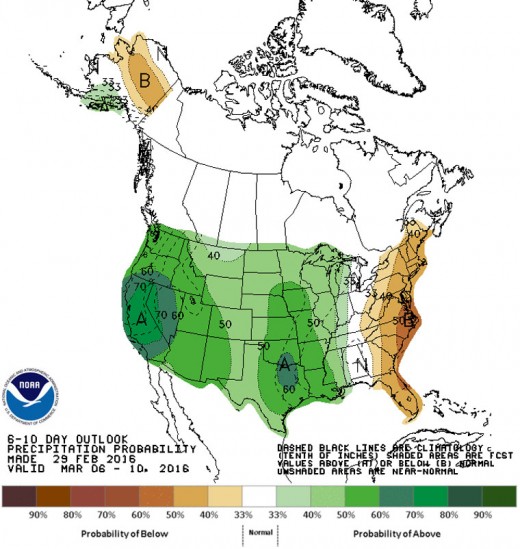
But the NWS and U.S. Forest Service meteorologists see this high-pressure system sliding further north and east, which will allow the storms to pass over Southern California during March and perhaps in April, too.
“The next several weeks should be above normal,” Tardy said. “There will be a series of storms, not necessarily flooding.”
Meteorologists are forecasting the first of several storms will arrive late this weekend or early next week.
While the forecasts are for above-normal precipitation during March through May, the average precipitation is predicted to be less than is normal for January or February.


