Repairs may take weeks and months
Roads into Idyllwild were closed for the second time in six months. This isolation is the result of an atmospheric river overflowing onto Southern California.
In late July and early August, the Cranston Fire caused the closure of highways 74 and 243. The latter was opened when the fire evacuations were lifted four days later on July 29.

The atmospheric river dropped record rain on Southern California, creating a wet, very wet Valentine’s Day.
Courtesy National Weather Service
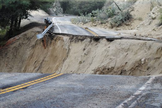
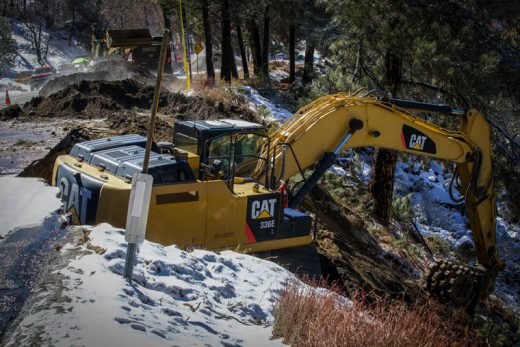
These new closures will be effective for weeks and months for Highway 243, according to Cal Trans. Highway 243 has been completed severed (both lanes gone) in two places north of Lake Fulmor. On Friday, Feb. 15, Cal Trans issued an $8 million emergency contract for repair work on highways 74 and 243.
The rain started Wednesday, Feb. 13, and became heavier overnight. By morning, the town was drenched. Highway 74 west to Hemet was passable at 8:30 a.m., but at least six rock slides caused drivers to shift lanes. By 10 a.m., the highway was closed.
By noon, Highway 243 was closed at the bottom of the mountain in Banning.
On Tuesday, Caltrans opened Highway 243 between lower Saunders Meadow Road and town in both directions. Only one lane is open with a flagman while repairs continue.
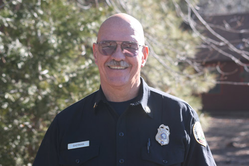
“The California Highway Patrol is working closely with Caltrans engineers and contractors to minimize the negative impact on community members impacted by the Valentine’s Day storm. We are asking our community members to remain engaged with us on social media via our Facebook page (CHP – San Gorgonio Pass) and Instagram page (chp_sangorgonio). We will continue answering questions and concerns as they arise. Road closure and detour information can be found on Caltrans’ QuickMap mobile application,” wrote CHP Capt. Mike Alvarez of the San Gorgonio office.

From 2 p.m. Wednesday, Feb. 13, until midnight, the U.S. Forest Service’s Keenwild Ranger Station recorded about three-quarters of an inch of rain. In the next 24 hours, by midnight Thursday, Keenwild recorded 6 inches.
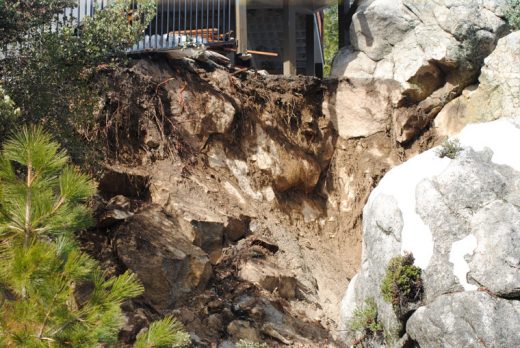
Photo by JP Crumrine
Overall, from Wednesday through Saturday, Keenwild recorded 7.5 inches of rain.
Then from Sunday afternoon until early Monday morning, a massive snowstorm covered the Hill. More than 4 inches of snow fell in Garner Valley, and the National Weather Service reported 4 inches of snow in Anza. Nearly 8 to 10 inches were recorded in Idyllwild.

While the sun was expected to return Tuesday and Wednesday, another snowstorm of about equal strength is forecast for Wednesday night through Thursday. Next weekend is expected to be dry. However, temperatures in the 50s may be weeks in the future.
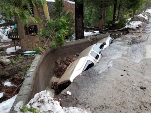
Photo by thom wallace
Contributing to the presence of the atmospheric river over Southern California is a weather pattern called El Niño. NWS has officially announced that a weak El Niño has formed.
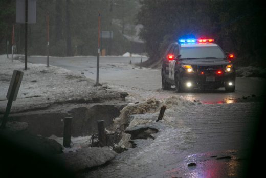
Photo by Jenny Kirchner
In its February El Niño report, the NWS said, “El Niño conditions formed during January 2019 … Because forecasts through the spring tend to be more uncertain and/or less accurate, the predicted chance that El Niño will persist beyond the spring is 50% or less.”

Through Tuesday morning, Feb. 19, Keenwild has recorded nearly 24 inches of rain since Oct. 1, 2018. The long-term average rainfall during this five-month period is 16.3 inches and the March average is 4.1. So, Keenwild has received nearly a year’s worth of rain.
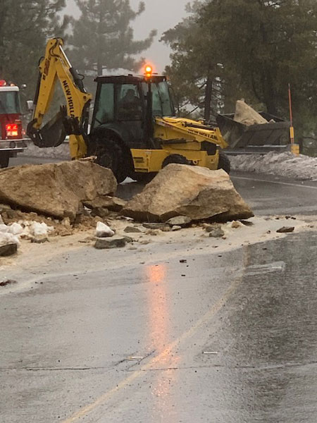
Photo by Becky Smith
Of note, the highest reported wind gust Sunday night was 75 mph at Mountain Center. The next closest on the mountain was 46 mph at Pinyon Pines.