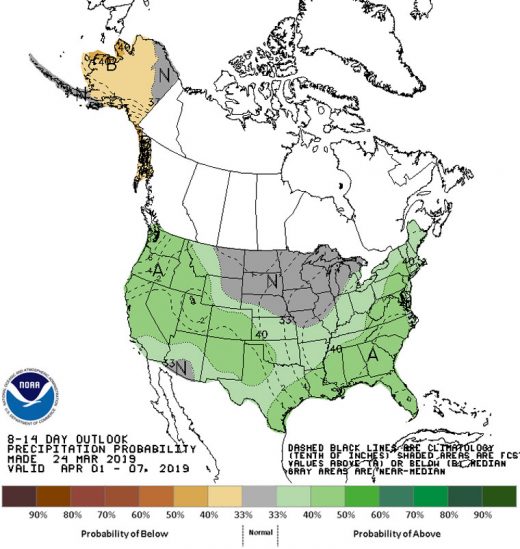
The National Weather Service is forecasting an above-average probability of precipitation over the next two weeks, into mid-April, but also above-average temperatures in early April. Courtesy National Weather Service
The weekend was warm and sunny. The National Weather Service is forecasting more warming to the middle of the week. Light showers may come Wednesday night and early Thursday, but then significantly warmer temperatures next weekend should usher in April.
In the longer-term, the NWS forecasts a higher-than-normal probability of precipitation for Southern California over the next two weeks, along with above-average temperatures.
“[It’s] also possible that at least average, if not a little bit above average, conditions [will continue] with more storming possible for very late March into the first part of April,” said Alex Tardy, meteorologist for the NWS San Diego office.
Last week, more precipitation fell on the Hill. From Wednesday evening into Friday, the U.S. Forest Service’s Keenwild Ranger Station recorded nearly an inch of rain. Total rainfall recorded at Keenwild since Oct. 1, 2018, has been 27.75 inches.
The historic average rainfall from October through March has been 20.5 inches.
The Cranston Ranger Station recorded 1.1 inches and Idyllwild Fire Station received nearly half an inch of rain last week.
The rainfall at Cranston was the second-greatest for those three days in the San Diego region and Keenwild’s amount was the fourth largest.