
Local first responders are using a new app to simplify communicating the exact locations of those in need of assistance. The app is called what3words (W3W) and can be downloaded for free. It divides the Earth’s surface into squares 3 meters per side, (57 trillion of them) and assigns a unique combination of three common words to each one. A person calling for help can give those three words to a dispatcher, who can easily communicate the exact location to police, fire or medical personnel.
Ride and delivery services are using the app, as well as businesses and humanitarian organizations seeking to improve “last mile delivery efficiency” (from what3words.com.) In 2018, Mercedes-Benz acquired a 10% share in the company and has begun incorporating the system into its onboard entertainment and navigation systems.
The developers’ theory is that three words are easier to communicate than longitude and latitude numbers, including degrees, minutes and seconds. The program uses a proprietary algorithm to assign the words. Sound-alike words are eliminated, and near matches are assigned to squares so far apart on Earth that a dispatcher would never be confused. Common words are used for places more heavily trafficked.
For example, sitting on the bench surrounding the flagpole in the center of IdyPark, as one moves around the circle to face the four converging paths, one would move between squares tagged “rambler/whisks/calculating,” “refrained/scares/waveform,” “longstanding/repeating/boring” and “weakening/truth/rejoined.” Another user would find you without having to explain where you were or which direction you were facing.
A recent Press Enterprise (PE) story quoted Los Angeles Fire Department Battalion Chief Tim Wuerfel: “It takes the search out of ‘search and rescue’ because we know exactly where they are.” His department adopted the technology in July 2021.
Riverside County also is prepared to handle calls from W3W users. Riverside County Sheriff’s Department Media Information Bureau Sgt. Edward Soto said, “Our dispatch staff is familiar with the What3Words app and are readily available to use it if necessary. The app seems very popular in Europe, the East Coast, and has even gained a little steam here on the West Coast. Having said that, we are on the cutting edge of location accuracy and our dispatchers are ready in the event it is used. We have not utilized the new program with any rescues to date, but are certainly prepared if need be.”
The PE story added that the three-word codes show up automatically on calls to Riverside and San Bernardino county sheriffs, and that “Riverside city firefighters have used what3words to rescue people in remote Sycamore Canyon Park and the thickly brushed Santa Ana River. Each fire engine has a cellphone with the app.”
The program has its critics. Because the algorithm used to assign words is proprietary, no one is able to really evaluate how closely it matches its goals. An article on cybergibbons.com by researcher Andrew Tierney points out that the list of words used includes easily confused pairs like “once” and “wants”, “census” and “senses,” “incite” and “insight,” to name a few. The algorithm, in theory, assigns these possible sound-a-likes to distant squares, but confirming this is difficult, the cybergibbons story claims to have found many confusable pairs in proximity, and posits that missing plurals could result in emergency personnel being sent miles away from an accident.
The discussion there and elsewhere points out that when evaluating the suitability of an app like this, one must include the failure mode of other systems. An imperfect tool may still be an improvement. W3W also notes that the app is usually used in conjunction with other information, and “… the call handler will often (but not always) have a GPS location from the caller’s device …” (what3words.medium.com)
W3W is one player in a growing field. Other apps providing a similar service include GoogleMaps, Connect Rocket, YourLocation and Mapcode. Most modern phones have the ability to send your location as a text message to emergency services.
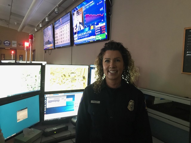
In response to email questions, Cal Fire and Riverside County Fire Department Public Information Officer Jody Hagemann invited the Crier to visit their Perris dispatch center.
The dispatch center is kept in perpetual half light for the best screen-viewing conditions. Occasional red lamps provide orientation without forcing eyes to re-adjust. Hagemann filled in the background on the functioning of the dispatch center.
JH: “We handle 500 to 600 incidents a day. We are an all-risk agency: We respond to medical emergencies, fire, haz-mat, public service assist, we do everything. When someone dials 911 we are a secondary PSAP (public safety answering point). [Calls] are transferred [to us]. We do get primary calls on the 800 or seven-digit emergency lines, but all other calls are transferred from a Riverside County law enforcement agency. Example: call for a house on fire. Someone dials 911 and reports. Wherever that person is calling from is routed to the closest PSAP, and then transferred. Once call type is determined, it is transferred to the jurisdictionally responsible agency. If they are calling within our response jurisdiction, it would go to us.
“Sometimes more than one agency would respond. We handle everything in Riverside County with the exception of Cathedral City, Palm Springs, Corona, Riverside City, Murrieta, Canyon Lake, Calimesa, Blythe, Idyllwild and Hemet. They all have their own fire agencies. However, they assist each other through auto and mutual aid requests.
“911 dispatchers are the first point of contact. Our dispatchers are trained in Emergency Medical Dispatch and Emergency Fire Dispatch, also known as EMD and EFD. We are certified through the International Academy of Emergency Dispatch. We are able to triage calls and give life-saving, pre-arrival instructions over the phone while the first responders are in route.”
Erin Goff, a fire communications dispatcher (FCD) II, explained that dispatchers are hired at level I, “probation,” and II is “journey” level. The next level is the option to promote to senior FCD.
The center has 52 dispatchers, Goff said, with another 26 in training. On an average day (four shifts; day, swing, evening, graveyard) about 15 to 20 dispatchers are on the floor, and more during an “incident.”
EG: “When we have a major incident that is going to be extended, meaning more than 24 hours, we get additional staffing. Days off, overtime, team that works our expanded office, those dispatchers are assigned to the incident while everyone else on the team can function for day-to -day calls.”
TC: “What can you tell our readers about the technology you are using here?”
EG: “We have a program we use called ‘RapidDeploy’ by Radius Mapping. New generation 911 technology, NG911. It is a cloud-based system that interfaces with other agencies.”
TC: “Why is that important?”
EG: “So we can find our callers. [The screen] tells me it was a cellphone call. It gives me a couple of tools I can use to find my caller. W3W is one of those tools we can use to locate a caller in an emergency. No better or worse than any other tool. If someone calls and gives me a Google ‘pin drop’ that gives a lat. and long. [latitude and longitude] for where they’re at, within 1 meter accuracy. W3W gives 3 meters. W3W can be valuable because it’s easier … ‘Race.upstairs.landmark’ is easier to relay than reading degrees, minutes, seconds. If someone is hiking on the PCT and they break their leg and they text a friend with W3W (sometimes texting is easier than voice coverage, a phone keeps trying to send in poor reception areas) they call us and give us the W3W, we are able to find them.
“It’s just as easy to open Google maps and drop a pin and share that with a friend. There is a share button on the app; you can send that to a friend. “
TC: “What other app-based tools do you use?”
EG: “W3W, Google Maps, Google Plus Codes; RapidDeploy takes all these tools and puts them to use so we can find the person.”
As an example, Goff put the above W3W code into RapidDeploy, and the screen showed us where we were in the command center.
TC: “Can you tell about times you’ve used W3W?”
EG: “I did have a situation where the caller didn’t have their W3W, but based on the cellphone location I could see their W3W. It was a medical emergency in the middle of the desert, and I was able to put the W3W into the call, the firefighter downloaded the app to his phone, used the W3W and was able to navigate to the person’s exact location.
“We had another call I heard about this morning, a patient that was, I believe, mountain biking, and knew their W3W and sent it to the wife and we were able to locate the patient. I know other agencies are using it.”
Hagemann and Goff pointed out that this story will be published during National 911 Public Safety Telecommunicator Week, the second week of April.
Hagemann put this technology into perspective: “Compared to when I was in dispatch, 1990-2007, the technology to locate patients and get resources to incidents has increased exponentially… tenfold. We are very fortunate to have this tech; it gets help to callers in the quickest and safest manner. When I started, we were using map books, Thomas Guides and topography maps. Our record keeping was done by hand, writing on incident cards.”