By JP Crumrine
This past weekend was wet. Several inches of rain fell on the Hill, but fortunately not like February 2019 when more than 8 inches fell in hours, or even the 6 inches or more on the San Bernardino Mountains.
And the Monday forecast expects more precipitation this week. Through Wednesday, the National Weather Service said a second system Tuesday and into Wednesday will bring “. . . widespread rain and mountain snowfall for areas above 5,000 feet. . . A third system may bring additional by late Thursday or Friday. . . “
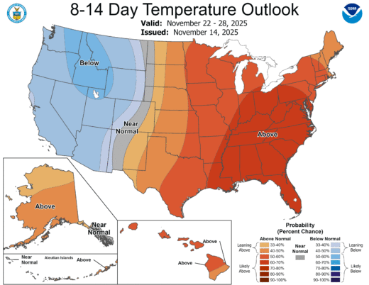
In fact, the NWS expects some snow Monday night into Tuesday afternoon. After this week, longer term, for the next month, the NWS is forecasting normal temperatures and precipitation for Southern California.
The current La Niña is expected to remain weak, according to the NWS Climate Prediction Center and continue through early winter. Consequently, winter and early spring may be warmer and drier than normal.
Despite the precipitation, which has certainly diminished drought conditions, temperature records were still being set in the past two weeks.
From Friday, November 14 through Monday morning, November 17, Idyllwild Fire Department recorded slightly more than 1.5 inches of rain. This brought the annual rainfall since January 1 to 12 inches, of which more than a third has fallen since September 1.
Keenwild Ranger Station recorded about 1.8 inches of rain this weekend and Pine Cove had nearly 2.5 inches of rain, for a total of 13.6 since the beginning of the year.
While the weekend rainfall did not set any local records, nearby in Palm Springs, San Jacinto, and San Diego, their totals did set records for November 15.
On the Hill, the 25-year average rainfall from January through November is 19 inches and 22 inches for the year.
Through November 11, before this weekend’s precipitation, nearly 50 percent of California was free of any drought conditions. And there were no areas of extreme or exceptional drought. November 2024 was the last time this occurred.
All of San Diego County and about half of Riverside (the western portion) were considered in level 2, Severe Drought.
But not just precipitation has affected the Mountain. From November 9 through November 11, Idyllwild set record high temperatures. On November 9, it reached 83 degrees, 5 degrees more than the previous high set in 1980. It was 79 degrees the next day, tying the 1956 record. On November 11, it reached 78 degrees tying the 1976 record.
Then on November 14, the overnight temperature fell only to 50 degrees which tied the record of the highest overnight temperature since 1970. The next night’s high of 45 degrees beat the 2017 high of 43 degrees for the day’s lowest temperature.
“Well, next week is looking pretty wet as well across all of California! There is considerable uncertainty surrounding the details, and another heavy rain event cannot be ruled out in Southern California (at least light to moderate additional rain is quite likely). It currently looks like two distinct systems (both faster-moving than this weekend’s sluggish low) will swing through, bringing quick bursts of rain/wind and some isolated thunderstorms. Both of these do look somewhat colder than the present storm–. . . and so I would expect better mountain snow accumulations at lower elevations with these subsequent systems later in the week,” wrote Dr. Daniel Swain, a climate scientist with joint appointments as a climate scientist within the California Institute for Water Resources within University of California Agriculture and Natural Resources, the Institute of the Environment and Sustainability at UCLA, and a research partner at the National Science Foundation’s National Center for Atmospheric Research, in his “Weather West” posting on November 14.


