Fire Chief & Operational Area Fire & Rescue Coordinator
Cal Fire/Riverside County Fire Department
Editor’s note: Chief Hawkins uses an imaginary, but realistic, scenario to describe the thought process and actions of an incident commander during a fire on the Hill. This is continued from last week.
This is the first of a two-part series. The first part will deal with Santa Ana winds and wind-driven fires, which likely will be part of our lives very soon. The second part will cover readiness or preparedness for a wildfire.
Fall is that time of year in Southern California when Santa Ana winds, a meteorological phenomenon, arrive and inordinately exacerbate fire risk to individuals, communities and properties. What are and what causes Santa Ana winds? What is the scientific name for the winds? What do fire chiefs and firefighters do to prepare for the onslaught of Santa Ana winds? What can you do to prepare for the winds?
Santa Ana winds blow from high pressure to low pressure and from high elevation to low elevation or the coast. In meteorological terms, the winds are called a Foehn Wind. They can blow from 20 to 100 mph.
Some believe the winds were named Santa Ana in memory of General Santa Ana. Others more commonly state the winds are named for their driving force down the Santa Ana River wind corridor from the San Bernardino Mountains through Riverside and Corona to the coast. The winds are also frequently called “Devil winds.”
When a high-pressure air mass settles over the Great Basin and the Upper Mojave Desert with a low pressure over the Pacific Ocean, Santa Ana winds will blow from the high-pressure area (massive dome of tall air) to the low-pressure area (hole or sink). The greater the air pressure differential between the high and low, the greater the wind velocity.
With the high pressure area over the Great Basin or high desert area, the wind arise in a literally high elevation and a very cool, dry environment. The wind blows clockwise as it exits the high pressure and then blows downhill to the coast across more desert area where it loses whatever slight moisture it had at its origin.
When the wind reaches Southern California, it is channeled through certain passes in the mountain ranges (San Jacinto, San Bernardino, San Gabriel and Santa Monica mountain ranges) increasing the wind pressure much like a small-diameter nozzle increases your water pressure delivered from a garden hose. So, the wind reaches Southern California with much greater velocity and is extremely dry.
These passes include the Soledad Pass, the Cajon Pass and the San Gorgonio Pass, all well known for exaggerating Santa Anas as they are funneled through. As the wind narrows and is compressed into the passes, its velocity increases dramatically, often to near-gale force or above.
At the same time, as the air descends from higher elevation to lower, it is heated adiabatically, warming about 5 degrees F. for each 1,000 feet it descends (10 degrees C. for each 1,000 m).
As it warms, its capacity to hold moisture increases, so its relative humidity decreases. The air has already been dried by orographic lift before reaching the Great Basin, as well as by subsidence from the upper atmosphere, so this added warming often causes relative humidity to fall below 10 percent. The end result is a strong, warm and very dry wind blowing out of the bottom of mountain passes into the valleys and coastal plain.
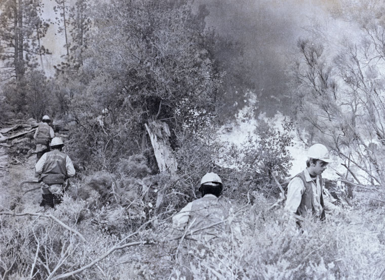
Santa Ana winds raise havoc with fires, both wildland and structural. The winds forcefully push the fires throughout a burning building or wildland environment. Of course, the winds also feed more oxygen to the fire and since oxygen is one of the three factors (the other two factors are fuel and heat) necessary for a fire to burn, the fire dramatically increases in intensity. With the wind velocity also comes very, very dry air. The relative humidity during a Santa Ana wind event will often drop below 5 percent and even reach 1 percent. Any time the relative humidity is below 20 percent, fires very actively burn.
As has been previously written, fuel, weather and topography are the three spread factors for a wildland fire with the weather factor being the most variable. Wind is the most serious driving force for any wildland fire. This is especially true any time a wind blows more than 20 mph. During serious Santa Ana wind outbreaks, the wind may reach 60 to 100 mph. Strong winds can easily drive a wildland fire forward at a 3 mph pace or even greater speed in the known wind tunnels.
Whereas summer winds generally don’t blow around the clock, Santa Ana winds blow 24 hours per day until they reverse to an onshore wind pattern. Fires that start at night under Santa Ana wind conditions are particularly devilish. While people are sleeping at night, an insidious Santa Ana wind-driven fire can race into a neighborhood.
Residents will awaken to find a fire surrounding their house. Hopefully, firefighters and law enforcement officials will have had time to alert residents of the approaching fire, but that has not always been the case with rapidly spreading fires. A perfect example was the Oct. 25, 2003, Cedar Fire that started east of Ramona, San Diego County, burned 25 miles forward in 16 hours and killed 15 people.
Weather systems always seek to reach equilibrium. The same is true for Santa Ana winds that fight with coastal or onshore winds during the declining hours of the Santa Ana wind. This is a most dangerous period for firefighters during transition from Santa Ana to coastal winds. Many firefighters have been burned during the transitional period. Historically, a 180-degree wind shift can trap firefighters.
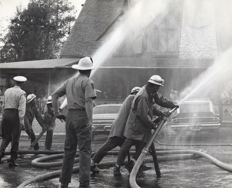
Historically, many large and damaging California wildfires have occurred under Santa Ana wind conditions. Firefighters always set their goals to protect in this order: 1) life, 2) communities and 3) individual property(s). Santa Ana winds drive fires on a wide front, immediately threatening the aforementioned exposures. Firefighters must very quickly develop an incident action plan that evacuates residents and defends exposures from the fire front.
Wildland fire agencies, like Cal Fire and the U. S. Forest Service, closely watch predictions for the possible development of a wind event. Both agencies will staff additional ground and air firefighting resources when Santa Ana winds are predicted. Extra fire prevention measures, particularly Red Flag Watches and Warnings, will be posted by the National Weather Service.
A great source of fire information for an emerging Santa Ana wind system can be found online at the South Ops Predictive Services Wildfire Threat Index: http://sawti.fs.fed.us/#8/33.995/-119.192. Two really good but old videos about Santa Ana Wind wildfires are: www.youtube.com/watch?v=yj0rfeF5GbA and www.youtube.com/watch?v=IIRpMxiHI_Q.
Part II of this series will cover what you can do to improve your preparedness and readiness should a Santa Ana wind-driven fire threaten you. We will discuss the importance of readiness and how fire agencies, the Riverside County Emergency Management Department, MAST, the Mountain Communities Fire Safe Council, Mountain Disaster Planning, etc. can assist you. Please follow Part II.
www.ready.gov/september
(To be continued.)
John Hawkins is the fire chief for the Cal Fire Riverside Unit and Riverside County Fire Department. He is entering his 54th year with Cal Fire and has served as the fire chief for going on 11 years. Chief Hawkins values leadership, fire and life safety and community involvement. He has been involved with the Riverside County Mountain Area Fire Safety Task Force since 2004.