

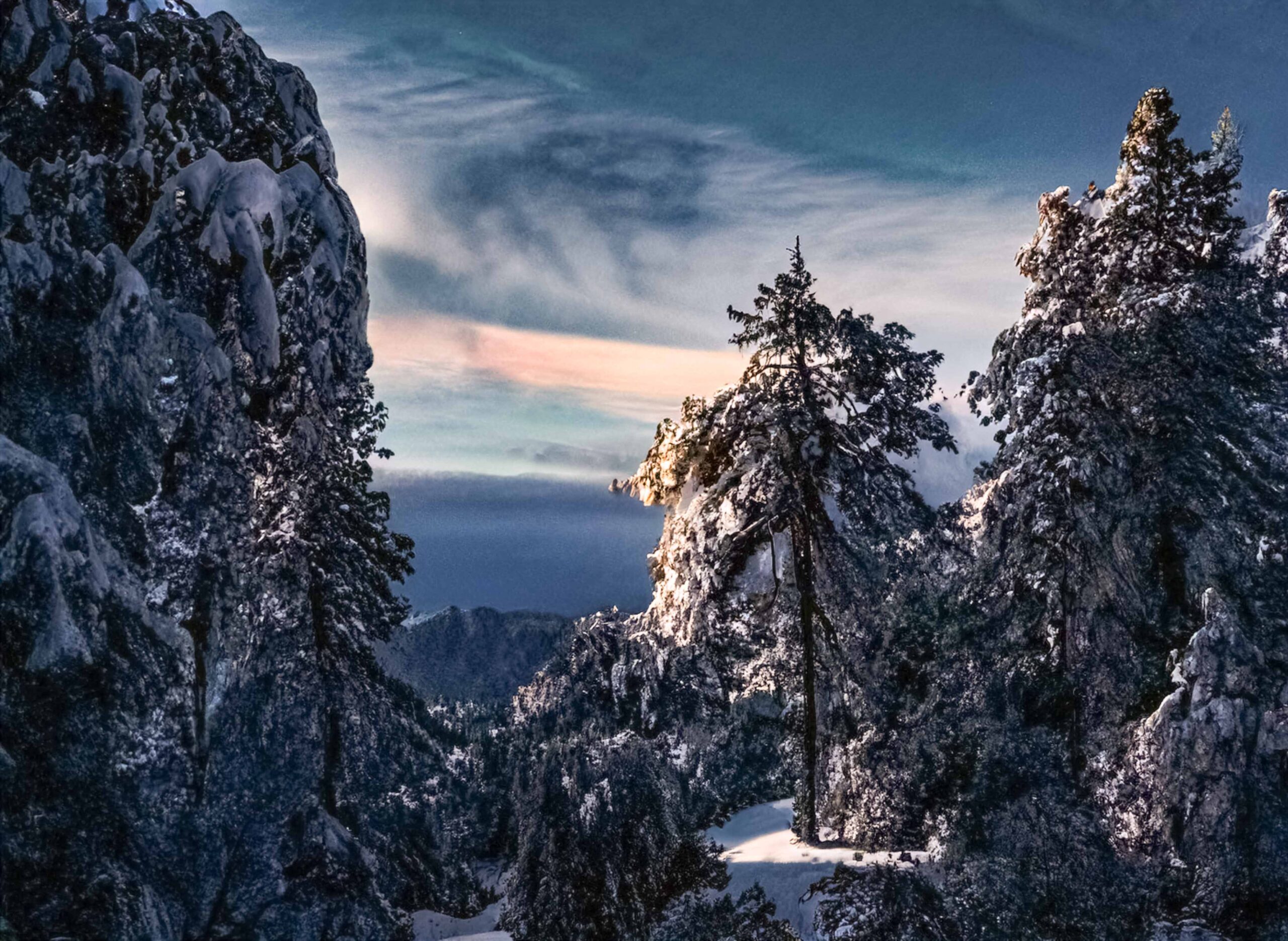
Rain and snow did pummel the Hill last week. It was significant, about an inch of rain and more than a foot a snow, but significantly less than the initial forecast. Nevertheless, it continued the progress in relieving drought conditions and augmenting fuel moisture.
Like a house guest who overstays their visit, the rain and snow are expected to continue this week, according to the National Weather Service’s (NWS) forecast. A winter storm watch is in effect until Wednesday evening with possible snow of 8 to 18 inches.

PHOTO BY PETER SZABADI
“Any precipitation will help. The higher the fuel moisture content the less probability of ignition,” wrote Idyllwild Fire Department Chief Mark LaMont in an email. “However, at the risk of sounding like a broken record, the rains always bring with them a light flashy grass crop which will carry fire into the heavier fuels. But, water in the aquifers and reservoirs is always a welcome surprise in the West.”

PHOTO BY JOEL FEINGOLD
Last week’s snowfall totals are not very accurate. As of Monday morning, Feb. 26, the NWS reported 17 inches in Idyllwild. Residents, looking outside, have reported 24 to 30 inches, depending on location, and closer to 3 feet in Pine Cove. And Anza recorded nearly 8 inches of snow.
PHOTO BY PETER SZABADI
Further north was a fountain of snow. Lake Arrowhead and Running Springs received nearly 6 feet of snow.

PHOTO BY PETER SZABADI
Rainfall totals, according to the NWS, ranged from 1.33 inches in Dutch Flats, 1.57 inches at the Keenwild Station in Mountain Center, to 1.80 inches in Poppet Flats. Through Monday morning, Idyllwild Fire Department reported about 1.02 inches of rain.

PHOTO BY PETER SZABADI
Sunday and Monday will be a brief refresh before another storm arrives Tuesday and lasts through Wednesday.
“A stronger disturbance will bring more widespread and heavier rain and mountain snow Tuesday night and Wednesday. Dry and slightly warmer weather is forecast Thursday through Saturday,” the NWS forecast Monday. “Snow levels will be from 3500-4500 feet with several inches of snow between 4,000-6,000 feet, and perhaps over 1 foot in some mountain locations above 6,000 feet.”
By Thursday, the precipitation ends, and warmer temperatures will return, according to the NWS.
As of Friday, Feb. 24, the snowpack was 173% of normal for this date. In the southern Sierras, the snowpack was 207% of normal. And both statewide and in the southern mountains it was well above the average snowpack for April 1.
