The great “Pineapple Express” of 2014 stormed through Northern California and then passed through Southern California. But on the Hill, only 1.1 inches of rain were recorded at the Keenwild Ranger Station. Idyllwild Fire Department recorded 1.37 inches of rain and George Tate in Pine Cove recorded 1.5 inches for the National Weather Service.
At Keenwild, the total rainfall since the beginning of the rain year (July 1) is still less than the long-term average rain through December, but it is getting closer. The Keenwild total is substantially less than the total rainfall recorded at the higher and northern elevations in Idyllwild and Pine Cove.
The July and August storms dropped much more rain in these areas than near Mountain Center. Consequently, Keenwild has received about 60 percent of the long-term average rain through December, which is 9.22 inches.
Rainfall in both Idyllwild and Pine Cove is currently more than the long-term average in December and since July 1 — by nearly an inch in Idyllwild and 1.7 inches in Pine Cove. In the first two weeks of December, Idyllwild has recorded 5.4 inches and 4.2 inches have been recorded in Pine Cove compared to the average December rain of 3.4 inches with another storm this week.
While the precipitation is needed, the volume remains insufficient to relieve current drought conditions. For example, Pine Cove will need another 15 inches before July 1, 2015, just to reach the annual average, which would be the first time since 2011 and only the second since 2005.
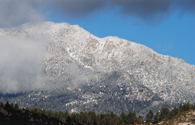
Although December appears to be a wet month, snowfall is below the long-term average. As snow slowly melts, it replenishes the groundwater and much less runs off.
This week’s storms may drop 2 to 4 inches of snow in Idyllwild and more at higher elevations. A chance of flash floods in the Mountain Fire burned areas also is possible with the rain forecast for this storm front, according to the NWS.
NWS is still uncertain about the longer-term precipitation prospects. As of early December, there was a 65-percent chance of El Niño weather conditions forming this winter. Usually, but not always, El Niño patterns bring more rain and snow to Southern California.
The NWS reported stated, “… the combined atmospheric and oceanic state remains ENSO-neutral. Similar to last month, most models predict … weak El Niño levels during November [to] January 2014-15 … Assuming that El Niño fully emerges, the forecaster consensus favors a weak event.”
Consequently, NWS’ drought forecast is for improving conditions, but the drought will remain.